Species distribution modelling using citizen science data
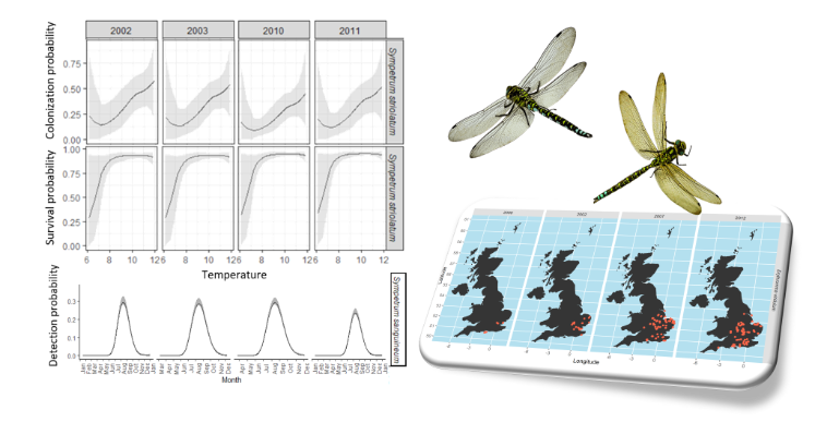
Modern methods for quantifying, predicting and mapping species distribution have played a crucial part in biodiversity’s conservation and the successful management of wildlife populations. With the growing concern over the effects that environmental changes have on species distributions and the rise of new technologies and information systems that facilitate access to environmental data, monitoring programs have a timely need for collecting information on multiple species across broad spatial and temporal scales. However, collecting data for such large-scale studies can be costly due to the amount of effort and experience needed for collecting and identifying samples from different species, limiting the spatial and temporal resolution of the study. Thus, citizen science projects, involving volunteers who help to collect data and monitor sites, offer a cost-effective solution to address research questions at spatial and temporal scales that would be otherwise difficult. Unfortunately, the analysis of these data is challenging because of the different sources of error that affect not only the ecological process of interest but also the observational process of how data is collected.
Researchers in the Statistics and Data Analytics group have been developing statistical methods for correcting for some of these sources of error (such as sampling bias and species imperfect detection) to analyze species diversity spatiotemporal data obtained from citizen science projects. Additionally, integrated models that combine the information from different sources such as museum collections, planned in situ surveys, radiotelemetry studies, and citizen science projects, are being developed to provide a more accurate description of the species distributions. Yet, combining such data sources is not an easy task due to the different sampling collection schemes which often differ by design, spatiotemporal support, and observational biases.