Landscape Archaeology Research Cluster @UofG
The interdisciplinary study of how humans have shaped, and are shaped by, the natural and built environments has long connected our work. Landscape Archaeology at the University of Glasgow focuses on the development of new approaches to data collection, analysis, interpretation, and modelling. These include remote sensing and survey, conviviality as an ethical intellectual framework for studying the landscape as a multi-actor system, experiential approaches and psychogeography, and the integrated analysis of large environmental datasets from local to continental scales. These allow us to consider how past land use impacts climate systems and how complex social phenomena like power, conflict, and memory are articulated through the landscape.
Our research community is enriched through collaborations with colleagues at the Scottish Universities Environmental Research Centre, bringing an emphasis on environmental archaeological approaches to understanding the landscape and human eco-dynamics, through active engagement with colleagues at Historic Environment Scotland, and with the broader heritage community through our role in developing SCARF, bringing engagement with the complex issues of making landscape heritage valuable to contemporary communities.
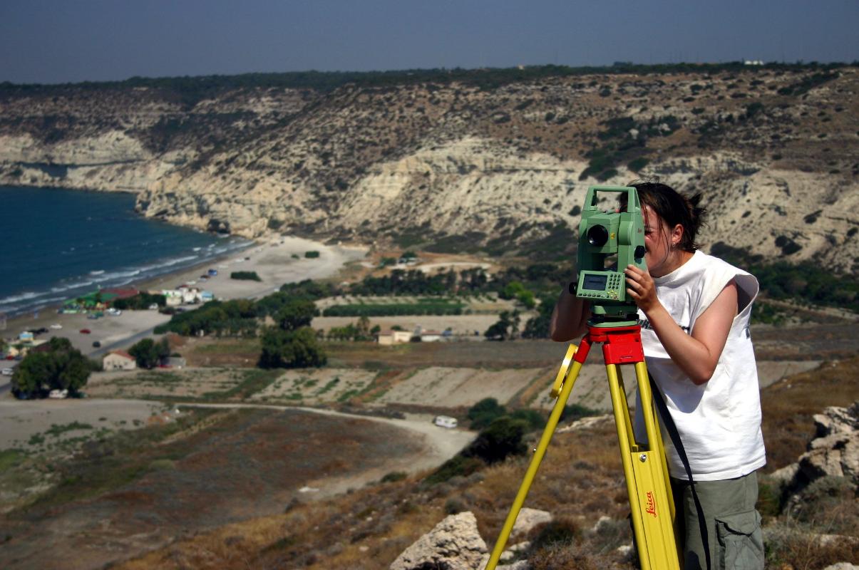
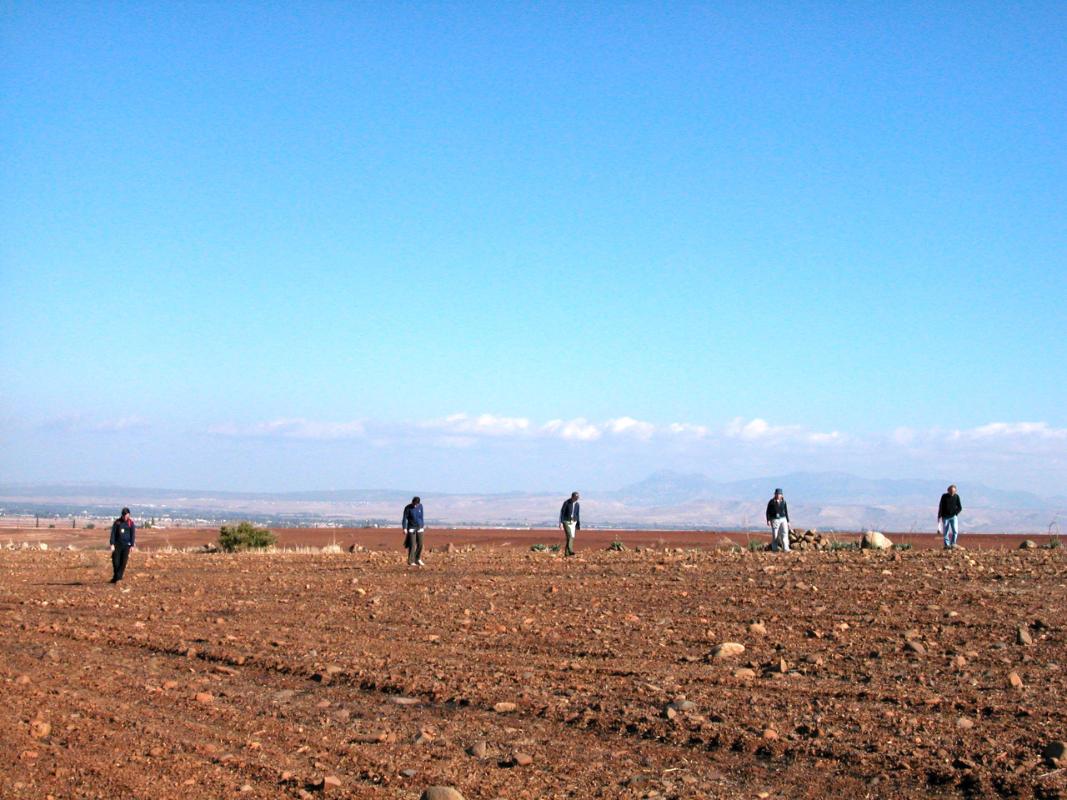
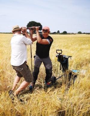
Our work is embedded in collaborations with colleagues in History, Classics, Celtic and Gaelic, History of Art, Geosciences, Computing Science, and Information Science within the University. Collaborative, transdisciplinary teams are essential to the success of our projects, and to our holistic approach to landscape archaeology. Landscape archaeological research @UofG is supported by a range of resources including access to a suite of survey equipment, laboratory analyses and microscopy, computing resources, established field research projects, and the active landscape archaeology community in Scotland, the UK, and abroad.
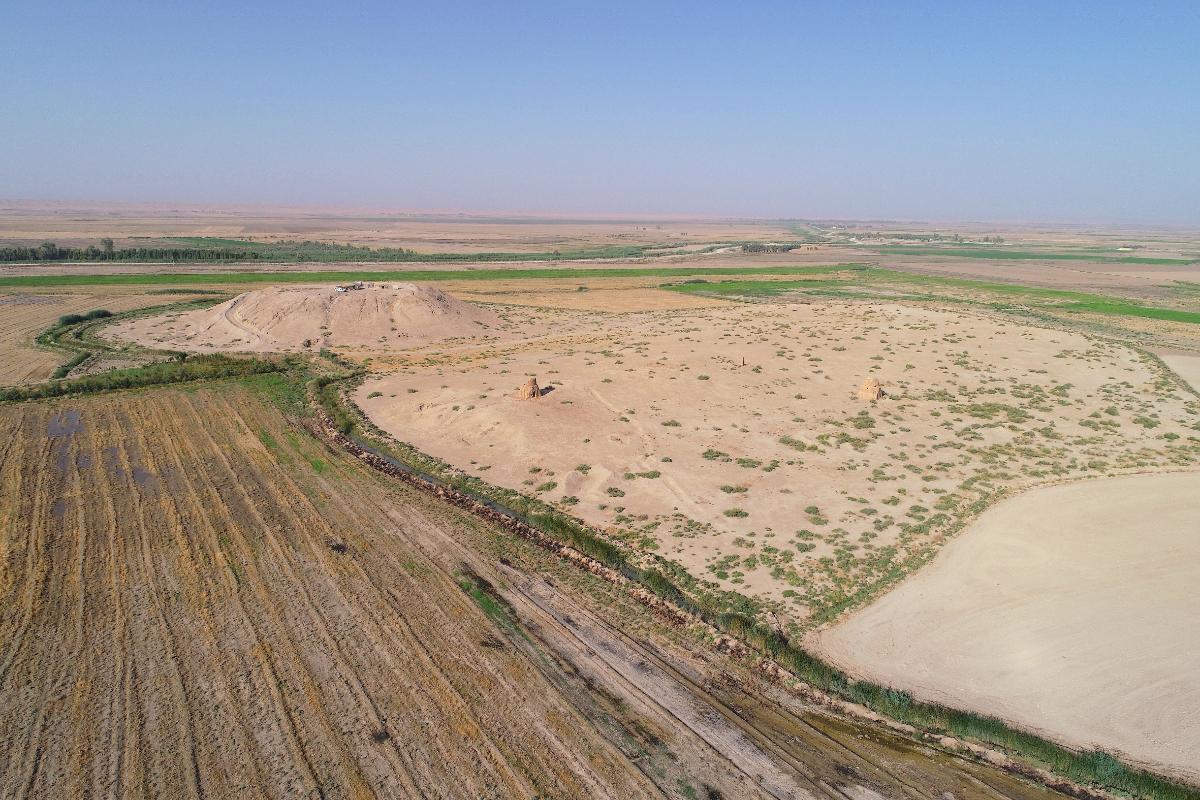
We carry out our landscape studies in varied contexts across the North Atlantic, Europe, the Mediterranean and the Middle East, from studies of the intertwined uplands and lowlands of the Kurdish Region of Iraq, to the urban-rural dynamics in central Italy, Neolithic to Medieval crannogs in Ireland and Scotland, to the lively urban prehistories of Scotland. These projects are linked by our ongoing collective conversations about the ‘why’ of our research, how we link our data and methods to our theoretical frameworks, and how we can better understand, articulate and engage with the complex phenomenon that is the landscape.
Find out more about our research ideas by visiting:
- Banks, I., Koskinen-Koivisto, E., & Seitsonen, O. (2018). Public Engagements with Lapland’s Dark Heritage: Community Archaeology in Finnish Lapland. Journal of Community Archaeology & Heritage, 5(2), 128-137.
- Brophy, K. (2015). Reading between the lines: the Neolithic cursus monuments of Scotland. Routledge.
- Casana, J., & Glatz, C. (2017). The Land Behind The Land Behind Baghdad: Archaeological Landscapes Of The Upper Diyala (Sirwan) River Valley 1. Iraq, 79, 47-69.
- Düring, B. S., & Glatz, C. (Eds.). (2016). Kinetic Landscapes: The Cide Archaeological Project: Surveying the Turkish Western Black Sea Region. Walter de Gruyter GmbH & Co KG.
- Glatz, C., & Casana, J. (2016). Of highland-lowland borderlands: Local societies and foreign power in the Zagros-Mesopotamian interface. Journal of Anthropological Archaeology, 44, 127-147.
- Given, M. (2018). Conviviality and the Life of Soil. Cambridge Archaeological Journal, 28(1), 127-143.
- Given, M. (2018). The precarious conviviality of watermills. Archaeological Dialogues, 25(1), 71-94.
- Opitz, R. S., & Cowley, D. C. (2013). Interpreting archaeological topography. Airborne laser scanning, 3D data and ground observation. Oxford: Oxbow Books (Occasional Publication of the Aerial Archaeology Research Group, 5).
- Opitz, R. S., Ryzewski, K., Cherry, J. F., & Moloney, B. (2015). Using Airborne LiDAR Survey to explore Historic-era archaeological landscapes of Montserrat in the Eastern Caribbean. Journal of Field Archaeology, 40(5), 523-541.
- Opitz, R., Nuninger, L., & Fruchart, C. (2015). Thinking topographically about the landscape around Besançon (Doubs, France). Landscape Archaeology between Art and Science., 395-412.
- Hamilton, W. D., Sayle, K. L., Boyd, M. O., Haselgrove, C. C., & Cook, G. T. (2019). ‘Celtic cowboys’ reborn: Application of multi-isotopic analysis (δ13C, δ15N, and δ34S) to examine mobility and movement of animals within an Iron Age British society. Journal of Archaeological Science, 101, 189-198.
People
Glasgow University Archaeology Staff
- Iain Banks
- Gareth Beale
- Kenny Brophy
- Daniel Calderbank
- Neil Erskine
- Michael Given
- Claudia Glatz
- Karen Hardy
- Tony Pollard
- Tessa Poller
- Nicki Whitehouse
Glasgow University Archaeology current and recent PhD students
- Chris Antler
- Aurime Bokute
- Gala Morris
- Rebecca Neil
Projects
- Agri-Dry: Dryland Agriculture and Land Use Past, Present and Future Resilience
- Archaeological Pasts and Sustainable Futures in Iraq’s Marshlands
- Bright Edge Deep - UK and Ireland
- Celtic Connections and Crannogs - UK and Ireland
- Cooling towers and stone circles: the heritage of Sighthill - Scotland
- Cultivating Societies - Ireland
- Gabii - Italy
- Into the Wild: Rewilding and the Historic Environment - UK
- ipaast-czo
- Karterouni - Cyprus
- PAGES LandCover6K
- Peatlands, Wetlands and the Historic environment
- Powerful Plants: The Power of Plants as Food, Medicine and Raw Materials Before Agriculture
- Reconstructing the ‘Wildscape’; Thorne and Hatfield Moors Hidden Landscapes - UK
- SERF - Scotland
- Sirwan Regional Project - Kurdistan
- Urban Prehistory - UK