

Redesigning Glasgow for wellbeing
Published: 19 May 2023
Cities use a large proportion of the world’s energy supply and are responsible for around 70% of global energy-related greenhouse gas emissions. Huge gains, in terms of reducing emissions, can be made by changing how cities are designed and connected. How is Glasgow confronting these issues?
As the world reckons with recent IPCC reports highlighting the urgent need to tackle the climate crisis, increasing urbanisation has meant cities are at the forefront of climate adaptation and mitigation. Over half of the world’s population lives in cities, and this is likely to increase to over two thirds by 2030. Cities use a large proportion of the world’s energy supply and are responsible for around 70 per cent of global energy-related greenhouse gas emissions. Huge gains, in terms of reducing emissions, can be made by changing how cities are designed and connected.
Cities that are integrated, compact and walkable with good public transport greatly reduce our per capita carbon footprint and are key to achieving many of the Sustainable Development Goals of which climate action is a key part.
The transportation sector is one of the largest causes of global GreenHouse Gas (GHG) emissions, contributing to 14% of the global annual emissions total, with 72% of those emissions caused by road vehicles, according to the World Resources Institute. Therefore, to take effective climate action, cities must be redesigned to reflect net-zero targets.
A recent piece in the Financial Times outlines the importance of prioritising wellbeing over economic growth at the city level, highlighting the need to create more spaces that foster connection. Research shows that today’s cities often exacerbate social and environmental disconnect. In the FT article, Barbara Bulc highlights how our planet’s multiple crises cannot be solved with ‘conventional thinking, top-down management and hierarchical social structures’ and instead we need to consider new approaches that are often ‘bottom-up, collaborative and inclusive’.
Recognising this, several cities have already taken bold action to tackle emissions and create more livable cities. Oslo, in Norway, has almost completely banned cars from its city centre. Meanwhile, Paris has been aggressive in ridding the city of cars by making streets friendlier to cyclists. Barcelona is pioneering a neighbourhood approach by overhauling its streets to create car-free superblocks. As one of the largest CO2 emitters, transportation has a vital role to play in cities’ shift to becoming thriving, healthy places for people to live. Recent moves to prioritise wellbeing and livability in cities have seen a renewed focus on pollution, accessibility and connectivity.

Winter cycling in Copenhagen. 80% of Copenhageners cycle all winter - and life carries on as normal. 'I will if you will'.
Credit: Colville-Andersen. Creative Commons
Glasgow’s car problem
Since Glasgow hosted the UN’s summit for climate change (COP26) in November 2021 the city has been taking steps to become a world leader in sustainability. The ongoing Glasgow city portrait project, which is part of the international C40 thriving cities initiative, brings together policy officers from several city council departments with the University of Glasgow and C40 Cities research team to explore what ‘thriving’ could look like in Glasgow. They have been analysing the City from interconnected perspectives of social and ecological wellbeing whilst reflecting on Glasgow’s local context and global reach. [You can read more about the early phases of the project here]
However, the current model of urban planning that the city is working around is both outdated and unsustainable. The issues the city faces today partly stem from systematic changes to how Glaswegians could move around the city. Intensive cuts to the city’s rail network preceded a suburban development model which has left the city with today’s car-centric design.
In Glasgow, planning decisions taken in the 1960s prioritised car use. The M8 motorway link through Glasgow’s city centre limits the city’s livability whilst potentially restricting sustainable development. If we take the arguments put forward in the wellbeing economy and doughnut economics models, an 8-lane motorway cutting through the heart of the city is restrictive at best.
In practice, the motorway is one of two providing near identical bypass times, but it is also the main route from the north to the south of the city and connecting its suburbs via the centre. Unfortunately this has been at the expense of the city centre. What was once a continuous, well-connected and integrated inner city is now ringed by a physical and psychological barrier. Connections between the West End and city centre have been severed or downgraded to subterranean passages (as on the Great Western Road).
Many of Glasgow’s once famous crosses (Charing, Anniesland, Anderston, Cowcaddens) - highly connected places where major routes between city centre and surrounds once met, were obliterated to make space for the motorway and now make pedestrian or wheeling journeys unpleasant, confusing and even dangerous. Connections between struggling communities north and north east of the city centre have been physically separated from the city centre by the M8 and the 1960s expressways which connect to it. The difficulty that these roads have created for all modes of transport besides the car make individual car journeys the most attractive option and make walking and cycling unpleasant and risky choices. The 1960s road network makes owning a car an expensive necessity for locals.
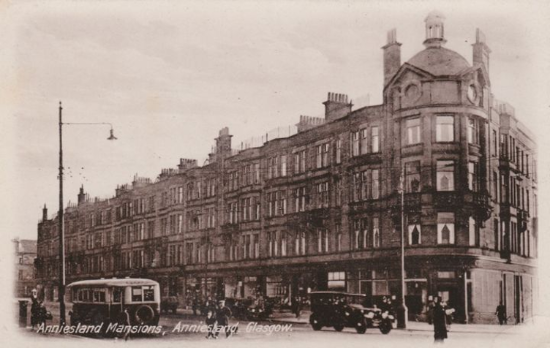
Anniesland Cross, located at the junction of Crow Road and Anniesland Road with Great Western Road. Source: Glasgow History.
Road over Rail
Published in 1963, the Reshaping of the British Railways report, commonly known as the Beeching report, would set in motion a drastic transportation change in Glasgow. The report saw about a third of the national rail network - 5,000 miles of track, including hundreds of branch lines, 2,363 stations and tens of thousands of jobs - cut from service across the UK. To justify the cuts, the report stated that much of the national rail network was no longer profitable. But the cuts were deeply controversial from the outset. When Richard Beeching, the report's lead author, visited Scotland in 1962, he was met by a wave of demonstrators. Whilst the cuts were rationalised financially they have since been compounded by under investment in local travel and the privatisation of Glasgow’s buses.
At the time, the Herald warned that many of the affected areas would benefit from retaining their rail networks - with social and environmental benefits put forward - the purpose and use of the railway went beyond their profitability by supporting communities’s social wellbeing. The now derelict crosses were once social hubs which, because of their importance, were given the special title of Cross and named after their location. They were often places where people would arrange to meet socially, transact business, or stand and wait, hoping to be hired for work. The Herald pointed to American cities where urban rail services were abandoned and areas resultantly became polluted by cars.
In Scotland, some of the cuts have since been reversed. But in Glasgow, residents are still left with a public transport network that has drastically shrunk in size since the 1960s.
The concurrent support of the suburban model in the 1960s saw Glasgow’s city planners wholly embrace the US’ city planning approach. National and local governments felt that the car was going to ‘save’ Glasgow from its socio-economic limitations and modernise it, bringing it in line with the larger metropolises in the United States and into the 21st century as a leading, modern economy. There was little evidence to support this belief, but local and nationalgovernments pressed ahead with developing the infrastructure anyway.
Today’s landscape
A recent motion passed by Glasgow City Council highlighted the ‘deeply damaging impact’ of the M8 on the city centre’s placemaking, dividing ‘the city centre and localities to its north and west’. Existing transport design had created many significant negative impacts on quality of life for communities across Glasgow and the West of Scotland, including ‘unsafe’ routes for walking, wheeling and cycling, and increased noise and air pollution, the motion added.
The motion argued that the maintenance costs for the M8 were ‘so significant as to warrant further investigation of possible alternatives, including but not limited to, full replacement’. The Replace the M8 (RM8) campaign has set out a number of possible alternatives for the M8.
After launching a petition calling on national and local governments to investigate the possibility of replacing the M8 with a corridor of businesses, parks and active travel infrastructure, an open letter to Scotland’s decision makers was penned. The campaign’s vision for the M8 corridor placed emphasis on people, sustainability and wellbeing:
The [M8] route could cater for vehicle journeys which originate within the city, but also be a major public transport, cycle and walking route. It would connect to the M74 and M8 at the edges of the city centre providing vehicle routes to and from the city which would be less congested by bypass traffic.
Land taken up by overly complex junctions, elevated ramps and associated leftover spaces could become repaired urban blocks of walkable streets, restoring lost links between the city centre and surrounding areas. The valuable land could generate considerable ongoing revenue for the city and raise surrounding land and property values. The sunken stretch of the route could carry north-south traffic leaving a large area at Charing Cross as a lively meeting place free from traffic. Large new parks could be created, canals uncovered, and new squares positioned in front of landmark buildings like the Mitchell Library. The overall result could be a city centre unconstrained by its concrete collar and reconnected with the West End and surrounding neighbourhoods. A healthier city would act as a magnet for new residents and businesses, and offer a more accessible, liveable and attractive city-centre for Glaswegians, however they choose to move through the city.
In March 2023, RM8 campaigners worked with Green councillors to draft a motion which would make it the official position of the council to work with Transport Scotland to work towards a phased approach to improving the motorway route with a view to eventual downgrading to a boulevard or similar. The motion was passed almost unanimously with cross party support. Soon after, the SNP councillor in charge of city centre regeneration and transport wrote a letter to the Minister For Transport formally requesting a start to work on options. Meanwhile the campaign’s Scottish Parliament petition remains under consideration, with signatures still being collected, and local discussions being led by MSP Paul Sweeney.
The post-COP26 landscape has strengthened an already strong grassroots climate movement across the city. The RM8 campaign embodies calls for recognition of the historical and contemporary damage done by the motorway to communities across the centre and north of the city. Springing out of resident concerns for health and wellbeing, and aligning with Glasgow’s hopes of becoming a ‘thriving city’, the campaign has led on reimagining who the infrastructure of Glasgow should serve. The campaign has mostly gathered support through social media and online outreach, complimenting wider campaigns across the city concerning active travel infrastructure, pollution and housing.
Article written by Ben Murphy, with support from Peter Kelly.
First published: 19 May 2023
<< Spotlight