Results
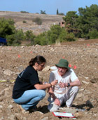
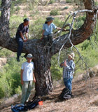
A full account of our aims and methodology, along with a detailed analysis of our survey area, can be seen in Joining the Dots, an online article in the peer-reviewed journal Internet Archaeology. This also includes maps, photographs and panoramas; interactive online GIS; a searchable database; and our full data archive.
The relationship between people and landscape in our area is a complex and diverse one. A major expansion of settlement in the Prehistoric Bronze Age, for example, was clearly based on the exploitation of both agricultural and copper resources, as well as proximity to communication routes. The Late Roman period shows an intricate organisation of settlements, agriculture, forest resources and communication routes to support the massive production of copper at the Skouriotissa mines.
In all cases it is clear that cultural factors are intimately intertwined with physical landscape factors: sacred places, strategic outlooks and the imposition (and avoidance) of taxation are just as important in past people's experience of the landscape as the availability of water or the outcropping of copper ores.
Themes
An important finding of our research is the diversity of social processes across the landscape at any one period. This is particularly clear in Roman period copper production based around Mavrovouni: the mines, miners’ settlement, smelting site and smelters’ settlement, communication routes, and agricultural sites all have their own place within the system.
Even in highly organised landscapes such as this, or in the large agricultural estates of the Medieval period, there is great diversity across the landscape. The Skouriotissa mines in the Roman period, for example, are supported by large scale agricultural production on the west of the mine but by dispersed interconnected farmsteads on the east. Even Roman or British imperial rule does not impose a single monolithic system on the landscape: there are always exceptions, tensions, diversity and resistance.
Our other most significant result on this general level is temporal diversity within the landscape. Apparent environmental constants, such as the copper resources of Skouriotissa, the woodland of the mountainous zone, or the alluvium of the valleys, are just as much cultural artefacts as are tools, households and settlements. And even when environmental factors do remain reasonably constant, the social response to them has varied enormously since the Neolithic era. In the Ottoman period the copper sources were irrelevant, while in the Archaic period it was more important for a settlement to be overlooked by a small sanctuary on a nearby spur than it was to be in close proximity to water or arable land.
Periods
For the prehistoric periods, the primary focus of settlement was in the Karkotis Valley. Here we identified a Late Chalcolithic site (Koutroullis), whose singularity does not conform to the usual Chalcolithic pattern of site clustering. All artefacts collected at Koutroullis suggest that it was a settlement site, and its groundstone assemblage points to some involvement in copper ore processing, not unexpected given the presence of excellent ore sources nearby, but surprising because of its very early date.
The other major locus of prehistoric activity in the survey region is at Laonarka, also in the Karkotis Valley, where we were able to identify a Prehistoric Bronze Age 2 habitational and mortuary complex in and around Katydhata village. This site has long known but whose function has always been debated.
The Late Roman period is remarkable not just for the quantity of material but also for its organisational diversity across the survey area. The large agricultural surplus produced by the intense settlement and agriculture of the Karkotis Valley supported the massive mining operation at Skouriotissa. This contrasts with a much emptier landscape with regular farmsteads, and occasional structures in the mountain valleys, perhaps providing fuel for the mines, or perhaps part of a separate and semi-independent economy.
The combination of intensive survey data and historical documentations has allowed us to develop our understanding of ‘community areas’ in the Medieval and Ottoman period, structured around a range of common activities within the territory of an estate or village. Even these show great diversity. The big estates of the well-watered Karkotis Valley clearly carry a different experience of the landscape for their workers and inhabitants than the little villages up to 800 m asl in the Troodos Mountains. Even within the Karkotis Valley, however, we have evidence for dramatically different agricultural and social landscapes.
TAESP in numbers
| Seasons (2000-2004) |
6 |
| Participants |
94 |
| Person-meals |
15,573 |
| Survey units |
1,119 |
| POSIs ('sites') |
253 |
| Sherds counted |
99,672 |
| Sherds analysed |
30,710 |
| Lithics analysed |
1,280 |
| Artefacts catalogued |
1,300 |
| Photographs |
12,522 |
| Database records |
32,459 |