

Remote sensing satellite and drone data research to support clean-up of India’s holy river
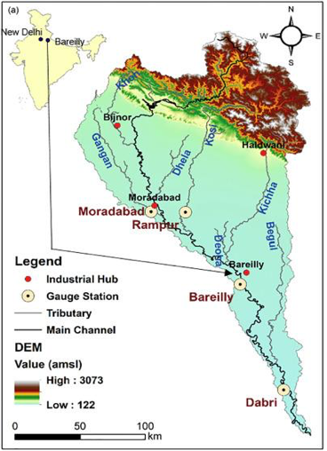
A super group of researchers from the University of Glasgow with different scientific backgrounds, ranging from statistics and chemistry to environmental sciences and ecology, are delivering sophisticated data science research to help improve monitoring of water quality for the Ramganga sub-basin of the River Ganges.
Covering 26 per cent of India's total landmass, water quality and water resources in the Ganges basin are vital for the wellbeing of one of the largest and densest global populations (43% of India's population). However, they are being compromised due to activities such as rapid industrialisation and urbanisation, and mitigation efforts are hampered by lack of historical and contemporary discharge and quality data.
Traditional water sampling is based on a small number of sites, and can be labour intensive and expensive, while this new research gathers data deployed from drones and new satellite missions to provide an efficient and unprecedented means of collecting significant data across a range of environments and pollution discharge scenarios of optical water types in the Ramganga basin.
Working with collaborators in India and the UK, the researchers will be generating new water quality data, improving the calibration of in-situ instruments, and delivering software tools based on innovative statistical models to extract value from existing and new data streams.
The project aims to make a globally significant contribution to the quality of life and ultimately the economic prosperity of millions of city and rural dwellers in the Ramganga river catchment and will contribute to the National Mission for Clean Ganga (NMCG).
For more information contact Surajit Ray