Mr Craig MacDonell
- Honorary Geospatial Research Technician (School of Geographical & Earth Sciences)
Biography
Craig came to the University of Glasgow as GIS & Remote Sensing Technician in 2019, having completed both a Bachelor of Science and Master of Science degrees at the University of Otago, Dunedin, New Zealand. Craig's degrees were primarily undertaken in the National School of Surveying at the University of Otago.
Craig's role has become mostly funded research and he transitioned to Lead Geospatial Research Technician in June 2024.
Research interests
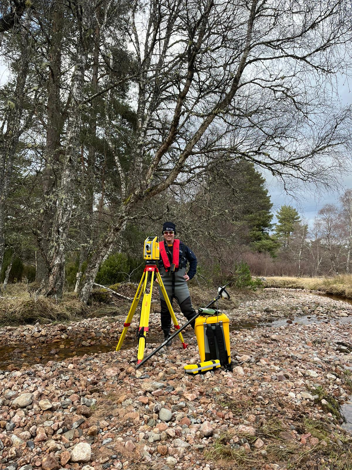
Craig's day-to-day role is to provide office and field-based technical support to research, knowledge exchange/impact and teaching activities in the School of Geographical and Earth Sciences (GES), mainly in the fields of Geographical Information Systems (GIS) and remote sensing/earth observation. He works across many facets of the School, but most extensively with members of the Earth Systems Research Group (ESRG), in both Geography and Earth Sciences/Geology.
Research activities involve collecting and processing a wide range of geographic data, often with UAVs (including development and ongoing compliance with commercial UAV permissions as one of the two qualified UK PfCO UAV pilots in GES) or other field survey equipment.
Craig's involvement in teaching activities has previously included writing, preparing, and updating lab materials for GIS and Remote Sensing courses, as well as delivering these to students (undergraduate and postgraduate taught) with academic staff.
General duties include troubleshooting GIS issues for staff/students, providing advice and support for other research (methods etc.), collating data from both students & staff, and general field assistance.
Craig is also one of the key contacts for ArcGIS licensing across the University of Glasgow.
Past & current research projects:
- 2020-2021: second National Coastal Change Assessment (NCCA2) for Scotland (Dynamic Coast 2) - Work Stream 6, social vulnerability and disadvantage to actual and predicted coastal hazards - published report
- 2021-2023: Consumer-grade UAV solid-state LiDAR performance evaluation - vegetated fluvial environment (River Feshie) - Earth Surface Processes & Landforms paper
- 2023-2024: Musselburgh Coastal Change Assessment - published report
- 2023 (ongoing): River Restoration analysis - EGU abstract
- 2024 (ongoing): Montrose Coastal Change Assessment
- 2024 (ongoing): Climate Ready Southeast Scotland (CRSES) - Coastal Risk Assessment (led by Sniffer, collaborating with 6 local authorities)
- 2024 (ongoing): Resilience of Anthropocene Coasts & Communities (RACC) - part of the Coast-R network
Publications
2026
Biles, E. et al. (2026) National-scale river water quality in the Philippines: establishing baselines in a mineralised megadiverse nation. Science of the Total Environment, 1011, 181192. (doi: 10.1016/j.scitotenv.2025.181192)
Daniels, Lucy J.  ORCID: https://orcid.org/0009-0007-0345-6467, Williams, Richard D. ORCID: https://orcid.org/0000-0001-6067-1947, Creed, Maggie J. ORCID: https://orcid.org/0000-0001-6694-8994, Quick, Laura, MacDonell, Craig J. ORCID: https://orcid.org/0000-0002-5516-5078, Moir, Hamish and Roberts, Kenny
(2026)
Let the riverscape grow! Riverscape rewilding restores lateral connectivity and promotes geomorphic recovery in a Scottish gravel-bed river.
Science of the Total Environment, 1010,
181102.
(doi: 10.1016/j.scitotenv.2025.181102)
(PMID:41351913)
ORCID: https://orcid.org/0009-0007-0345-6467, Williams, Richard D. ORCID: https://orcid.org/0000-0001-6067-1947, Creed, Maggie J. ORCID: https://orcid.org/0000-0001-6694-8994, Quick, Laura, MacDonell, Craig J. ORCID: https://orcid.org/0000-0002-5516-5078, Moir, Hamish and Roberts, Kenny
(2026)
Let the riverscape grow! Riverscape rewilding restores lateral connectivity and promotes geomorphic recovery in a Scottish gravel-bed river.
Science of the Total Environment, 1010,
181102.
(doi: 10.1016/j.scitotenv.2025.181102)
(PMID:41351913)
2025
MacDonell, Craig John ORCID: https://orcid.org/0000-0002-5516-5078, Williams, Richard David ORCID: https://orcid.org/0000-0001-6067-1947, White, Jon and Roberts, Kenny
(2025)
Seamless quantification of wet and dry riverscape topography using UAV
topo-bathymetric LiDAR.
Drones, 9(12),
872.
(doi: 10.3390/drones9120872)
Costaz-Puyou, Isabelle, Williams, Richard ORCID: https://orcid.org/0000-0001-6067-1947, Black, Andrew, Spray, Chris and MacDonell, Craig ORCID: https://orcid.org/0000-0002-5516-5078
(2025)
Re-meandering attenuates frequent high-flows and diversifies physical habitat in a gravel-bed river.
Journal of Environmental Management, 388,
125672.
(doi: 10.1016/j.jenvman.2025.125672)
(PMID:40449441)
Quick, L. et al. (2025) Confined and mined: anthropogenic river modification as a driver of flood risk change. npj Natural Hazards, 2, 4. (doi: 10.1038/s44304-024-00051-6)
2024
Naylor, Larissa A. ORCID: https://orcid.org/0000-0002-4065-2674, Edwards, David ORCID: https://orcid.org/0000-0001-6237-7434, Cotton, Isabel, Dixon, Deborah ORCID: https://orcid.org/0000-0003-0846-6959, Lacsny, Alice ORCID: https://orcid.org/0009-0000-2742-2244, Fradera, Kat ORCID: https://orcid.org/0009-0004-8569-2612, Hurst, Martin ORCID: https://orcid.org/0000-0002-9822-076X and MacDonell, Craig ORCID: https://orcid.org/0000-0002-5516-5078
(2024)
Coastal change adaptation – are we prepared?
Documentation.
ClimateXChange.
(doi: 10.7488/era/5741).
Cavazzin, B. ORCID: https://orcid.org/0000-0002-5120-9301, MacDonell, C. ORCID: https://orcid.org/0000-0002-5516-5078, Green, N. and Rothwell, J.
(2024)
Air pollution biomonitoring in an urban-industrial setting (Taranto, Italy) using Mediterranean plant species.
Atmospheric Pollution Research, 15(6),
102105.
(doi: 10.1016/j.apr.2024.102105)
2023
MacDonell, Craig John ORCID: https://orcid.org/0000-0002-5516-5078, Williams, Richard David ORCID: https://orcid.org/0000-0001-6067-1947, Maniatis, Georgios, Roberts, Kenny and Naylor, Mark
(2023)
Consumer-grade UAV solid-state LiDAR accurately quantifies topography in a vegetated fluvial environment.
Earth Surface Processes and Landforms, 48(11),
pp. 2211-2229.
(doi: 10.1002/esp.5608)
Boothroyd, R. J. et al. (2023) National-scale geodatabase of catchment characteristics in the Philippines for river management applications. PLoS ONE, 18(3), e0281933. (doi: 10.1371/journal.pone.0281933) (PMID:36888610) (PMCID:PMC9994713)
2021
MacDonell, Craig ORCID: https://orcid.org/0000-0002-5516-5078
(2021)
Mapping coastal erosion disadvantage in Scotland.
GIS Days 2021, London, Ontario, Canada, 15 - 19 November 2021.
Dunkley, Ria ORCID: https://orcid.org/0000-0003-0238-7344, MacDonell, Craig ORCID: https://orcid.org/0000-0002-5516-5078, Naylor, Larissa A. ORCID: https://orcid.org/0000-0002-4065-2674, Muir, Freya M.E. ORCID: https://orcid.org/0000-0003-4702-2963, Fitton, James, Rennie, Alistair, Hansom, Jim ORCID: https://orcid.org/0000-0002-4443-2089 and Hurst, Martin ORCID: https://orcid.org/0000-0002-9822-076X
(2021)
Using Coastal Erosion Disadvantage Maps as a Climate Change and Strategic Urban Planning Tool for Scotland.
Built Environment and Net Zero – A COP26 Conference from the Centre for Sustainable Solutions, 11 Nov 2021.
Rennie, A.F., Hansom, J.D. ORCID: https://orcid.org/0000-0002-4443-2089, Hurst, M.D. ORCID: https://orcid.org/0000-0002-9822-076X, Muir, F.M.E. ORCID: https://orcid.org/0000-0003-4702-2963, Naylor, L.A. ORCID: https://orcid.org/0000-0002-4065-2674, Dunkley, R.A. ORCID: https://orcid.org/0000-0003-0238-7344 and MacDonell, C.J. ORCID: https://orcid.org/0000-0002-5516-5078
(2021)
Dynamic Coast Research Summary (2021).
Technical Report.
Centre of Expertise for Waters.
Rennie, A.F., Hansom, J.D. ORCID: https://orcid.org/0000-0002-4443-2089, Hurst, M.D. ORCID: https://orcid.org/0000-0002-9822-076X, Muir, F.M.E. ORCID: https://orcid.org/0000-0003-4702-2963, Naylor, L.A. ORCID: https://orcid.org/0000-0002-4065-2674, Dunkley, R.A. ORCID: https://orcid.org/0000-0003-0238-7344 and MacDonell, C.J. ORCID: https://orcid.org/0000-0002-5516-5078
(2021)
Dynamic Coast: The National Overview (2021). CRW2017_08.
Technical Report.
Scotland's Centre of Expertise for Waters (CREW).
Dunkley, R.A. ORCID: https://orcid.org/0000-0003-0238-7344, MacDonell, C.J. ORCID: https://orcid.org/0000-0002-5516-5078, Naylor, L.A. ORCID: https://orcid.org/0000-0002-4065-2674, Muir, F.M.E. ORCID: https://orcid.org/0000-0003-4702-2963 and Fitton, J.M.
(2021)
Dynamic Coast: Mapping Coastal Erosion Disadvantage in Scotland.
Technical Report.
Centre of Expertise for Waters.
Dunkley, R.A. ORCID: https://orcid.org/0000-0003-0238-7344, MacDonell, C.J. ORCID: https://orcid.org/0000-0002-5516-5078, Naylor, L.A. ORCID: https://orcid.org/0000-0002-4065-2674, Muir, F.M.E. ORCID: https://orcid.org/0000-0003-4702-2963 and Fitton, J.
(2021)
Dynamic Coast: Mapping Coastal Erosion Disadvantage in Scotland. CRW2017_08.
Technical Report.
Scotland's Centre of Expertise for Waters (CREW).
Muir, F.M.E. ORCID: https://orcid.org/0000-0003-4702-2963, Hansom, J.D. ORCID: https://orcid.org/0000-0002-4443-2089, Rennie, A.F., Hurst, M.D. ORCID: https://orcid.org/0000-0002-9822-076X, Naylor, L.A. ORCID: https://orcid.org/0000-0002-4065-2674, Dunkley, R.A. ORCID: https://orcid.org/0000-0003-0238-7344 and MacDonell, C.J. ORCID: https://orcid.org/0000-0002-5516-5078
(2021)
Dynamic Coast: Adaptation and Resilience Options for Central Tiree. CRW2017_08.
Technical Report.
Scotland's Centre of Expertise for Waters (CREW).
Rennie, A.F., Hansom, J.D. ORCID: https://orcid.org/0000-0002-4443-2089, Hurst, M.D. ORCID: https://orcid.org/0000-0002-9822-076X, Muir, F.M.E. ORCID: https://orcid.org/0000-0003-4702-2963, Naylor, L.A. ORCID: https://orcid.org/0000-0002-4065-2674, Dunkley, R.A. ORCID: https://orcid.org/0000-0003-0238-7344 and MacDonell, C.J. ORCID: https://orcid.org/0000-0002-5516-5078
(2021)
Dynamic Coast: Adaptation and Resilience Options at the Bay of Skaill. CRW2017_08.
Technical Report.
Scotland's Centre of Expertise for Waters (CREW).
Rennie, A.F., Hansom, J.D. ORCID: https://orcid.org/0000-0002-4443-2089, Hurst, M.D. ORCID: https://orcid.org/0000-0002-9822-076X, Muir, F.M.E. ORCID: https://orcid.org/0000-0003-4702-2963, Naylor, L.A. ORCID: https://orcid.org/0000-0002-4065-2674, Dunkley, R.A. ORCID: https://orcid.org/0000-0003-0238-7344 and MacDonell, C.J. ORCID: https://orcid.org/0000-0002-5516-5078
(2021)
Dynamic Coast: Adaptation and Resilience Options for Golspie and Coul. CRW2017_08.
Technical Report.
Scotland's Centre of Expertise for Waters (CREW).
Rennie, A.F., Hansom, J.D. ORCID: https://orcid.org/0000-0002-4443-2089, Hurst, M.D. ORCID: https://orcid.org/0000-0002-9822-076X, Muir, F.M.E. ORCID: https://orcid.org/0000-0003-4702-2963, Naylor, L.A. ORCID: https://orcid.org/0000-0002-4065-2674, Dunkley, R.A. ORCID: https://orcid.org/0000-0003-0238-7344 and MacDonell, C.J. ORCID: https://orcid.org/0000-0002-5516-5078
(2021)
Dynamic Coast: Adaptation and Resilience Options for Montrose Bay. CRW2017_08.
Technical Report.
Scotland's Centre of Expertise for Waters (CREW).
Rennie, A.F., Hansom, J.D. ORCID: https://orcid.org/0000-0002-4443-2089, Hurst, M.D. ORCID: https://orcid.org/0000-0002-9822-076X, Muir, F.M.E. ORCID: https://orcid.org/0000-0003-4702-2963, Naylor, L.A. ORCID: https://orcid.org/0000-0002-4065-2674, Dunkley, R.A. ORCID: https://orcid.org/0000-0003-0238-7344 and MacDonell, C.J. ORCID: https://orcid.org/0000-0002-5516-5078
(2021)
Dynamic Coast: Adaptation and Resilience Options for St Andrews Links. CRW2017_08.
Technical Report.
Scotland's Centre of Expertise for Waters (CREW).
2018
MacDonell, Craig ORCID: https://orcid.org/0000-0002-5516-5078
(2018)
Practical planning of RPAS operations: an example on Quarantine Island/Kamau Taurua.
In: GeoCart'2018: Cartographies of Change: Then, Now and Tomorrow, Wellington, New Zealand, 5 - 7 September 2018,
ISBN 9780473452575
MacDonell, Craig ORCID: https://orcid.org/0000-0002-5516-5078, Sirguey, Pascal and Redpath, Todd
(2018)
Meeting expectations with RPAS topographic surveys, a practical example at mapping Quarantine Island/Kamau Taurua.
In: GeoCart'2018: Cartographies of Change: Then, Now and Tomorrow, Wellington, New Zealand, 5 - 7 September 2018,
ISBN 9780473452575
Articles
Biles, E. et al. (2026) National-scale river water quality in the Philippines: establishing baselines in a mineralised megadiverse nation. Science of the Total Environment, 1011, 181192. (doi: 10.1016/j.scitotenv.2025.181192)
Daniels, Lucy J. ORCID: https://orcid.org/0009-0007-0345-6467, Williams, Richard D. ORCID: https://orcid.org/0000-0001-6067-1947, Creed, Maggie J. ORCID: https://orcid.org/0000-0001-6694-8994, Quick, Laura, MacDonell, Craig J. ORCID: https://orcid.org/0000-0002-5516-5078, Moir, Hamish and Roberts, Kenny
(2026)
Let the riverscape grow! Riverscape rewilding restores lateral connectivity and promotes geomorphic recovery in a Scottish gravel-bed river.
Science of the Total Environment, 1010,
181102.
(doi: 10.1016/j.scitotenv.2025.181102)
(PMID:41351913)
MacDonell, Craig John ORCID: https://orcid.org/0000-0002-5516-5078, Williams, Richard David ORCID: https://orcid.org/0000-0001-6067-1947, White, Jon and Roberts, Kenny
(2025)
Seamless quantification of wet and dry riverscape topography using UAV
topo-bathymetric LiDAR.
Drones, 9(12),
872.
(doi: 10.3390/drones9120872)
Costaz-Puyou, Isabelle, Williams, Richard ORCID: https://orcid.org/0000-0001-6067-1947, Black, Andrew, Spray, Chris and MacDonell, Craig ORCID: https://orcid.org/0000-0002-5516-5078
(2025)
Re-meandering attenuates frequent high-flows and diversifies physical habitat in a gravel-bed river.
Journal of Environmental Management, 388,
125672.
(doi: 10.1016/j.jenvman.2025.125672)
(PMID:40449441)
Quick, L. et al. (2025) Confined and mined: anthropogenic river modification as a driver of flood risk change. npj Natural Hazards, 2, 4. (doi: 10.1038/s44304-024-00051-6)
Cavazzin, B. ORCID: https://orcid.org/0000-0002-5120-9301, MacDonell, C. ORCID: https://orcid.org/0000-0002-5516-5078, Green, N. and Rothwell, J.
(2024)
Air pollution biomonitoring in an urban-industrial setting (Taranto, Italy) using Mediterranean plant species.
Atmospheric Pollution Research, 15(6),
102105.
(doi: 10.1016/j.apr.2024.102105)
MacDonell, Craig John ORCID: https://orcid.org/0000-0002-5516-5078, Williams, Richard David ORCID: https://orcid.org/0000-0001-6067-1947, Maniatis, Georgios, Roberts, Kenny and Naylor, Mark
(2023)
Consumer-grade UAV solid-state LiDAR accurately quantifies topography in a vegetated fluvial environment.
Earth Surface Processes and Landforms, 48(11),
pp. 2211-2229.
(doi: 10.1002/esp.5608)
Boothroyd, R. J. et al. (2023) National-scale geodatabase of catchment characteristics in the Philippines for river management applications. PLoS ONE, 18(3), e0281933. (doi: 10.1371/journal.pone.0281933) (PMID:36888610) (PMCID:PMC9994713)
Research Reports or Papers
Naylor, Larissa A. ORCID: https://orcid.org/0000-0002-4065-2674, Edwards, David ORCID: https://orcid.org/0000-0001-6237-7434, Cotton, Isabel, Dixon, Deborah ORCID: https://orcid.org/0000-0003-0846-6959, Lacsny, Alice ORCID: https://orcid.org/0009-0000-2742-2244, Fradera, Kat ORCID: https://orcid.org/0009-0004-8569-2612, Hurst, Martin ORCID: https://orcid.org/0000-0002-9822-076X and MacDonell, Craig ORCID: https://orcid.org/0000-0002-5516-5078
(2024)
Coastal change adaptation – are we prepared?
Documentation.
ClimateXChange.
(doi: 10.7488/era/5741).
Rennie, A.F., Hansom, J.D. ORCID: https://orcid.org/0000-0002-4443-2089, Hurst, M.D. ORCID: https://orcid.org/0000-0002-9822-076X, Muir, F.M.E. ORCID: https://orcid.org/0000-0003-4702-2963, Naylor, L.A. ORCID: https://orcid.org/0000-0002-4065-2674, Dunkley, R.A. ORCID: https://orcid.org/0000-0003-0238-7344 and MacDonell, C.J. ORCID: https://orcid.org/0000-0002-5516-5078
(2021)
Dynamic Coast Research Summary (2021).
Technical Report.
Centre of Expertise for Waters.
Rennie, A.F., Hansom, J.D. ORCID: https://orcid.org/0000-0002-4443-2089, Hurst, M.D. ORCID: https://orcid.org/0000-0002-9822-076X, Muir, F.M.E. ORCID: https://orcid.org/0000-0003-4702-2963, Naylor, L.A. ORCID: https://orcid.org/0000-0002-4065-2674, Dunkley, R.A. ORCID: https://orcid.org/0000-0003-0238-7344 and MacDonell, C.J. ORCID: https://orcid.org/0000-0002-5516-5078
(2021)
Dynamic Coast: The National Overview (2021). CRW2017_08.
Technical Report.
Scotland's Centre of Expertise for Waters (CREW).
Dunkley, R.A. ORCID: https://orcid.org/0000-0003-0238-7344, MacDonell, C.J. ORCID: https://orcid.org/0000-0002-5516-5078, Naylor, L.A. ORCID: https://orcid.org/0000-0002-4065-2674, Muir, F.M.E. ORCID: https://orcid.org/0000-0003-4702-2963 and Fitton, J.M.
(2021)
Dynamic Coast: Mapping Coastal Erosion Disadvantage in Scotland.
Technical Report.
Centre of Expertise for Waters.
Dunkley, R.A. ORCID: https://orcid.org/0000-0003-0238-7344, MacDonell, C.J. ORCID: https://orcid.org/0000-0002-5516-5078, Naylor, L.A. ORCID: https://orcid.org/0000-0002-4065-2674, Muir, F.M.E. ORCID: https://orcid.org/0000-0003-4702-2963 and Fitton, J.
(2021)
Dynamic Coast: Mapping Coastal Erosion Disadvantage in Scotland. CRW2017_08.
Technical Report.
Scotland's Centre of Expertise for Waters (CREW).
Muir, F.M.E. ORCID: https://orcid.org/0000-0003-4702-2963, Hansom, J.D. ORCID: https://orcid.org/0000-0002-4443-2089, Rennie, A.F., Hurst, M.D. ORCID: https://orcid.org/0000-0002-9822-076X, Naylor, L.A. ORCID: https://orcid.org/0000-0002-4065-2674, Dunkley, R.A. ORCID: https://orcid.org/0000-0003-0238-7344 and MacDonell, C.J. ORCID: https://orcid.org/0000-0002-5516-5078
(2021)
Dynamic Coast: Adaptation and Resilience Options for Central Tiree. CRW2017_08.
Technical Report.
Scotland's Centre of Expertise for Waters (CREW).
Rennie, A.F., Hansom, J.D. ORCID: https://orcid.org/0000-0002-4443-2089, Hurst, M.D. ORCID: https://orcid.org/0000-0002-9822-076X, Muir, F.M.E. ORCID: https://orcid.org/0000-0003-4702-2963, Naylor, L.A. ORCID: https://orcid.org/0000-0002-4065-2674, Dunkley, R.A. ORCID: https://orcid.org/0000-0003-0238-7344 and MacDonell, C.J. ORCID: https://orcid.org/0000-0002-5516-5078
(2021)
Dynamic Coast: Adaptation and Resilience Options at the Bay of Skaill. CRW2017_08.
Technical Report.
Scotland's Centre of Expertise for Waters (CREW).
Rennie, A.F., Hansom, J.D. ORCID: https://orcid.org/0000-0002-4443-2089, Hurst, M.D. ORCID: https://orcid.org/0000-0002-9822-076X, Muir, F.M.E. ORCID: https://orcid.org/0000-0003-4702-2963, Naylor, L.A. ORCID: https://orcid.org/0000-0002-4065-2674, Dunkley, R.A. ORCID: https://orcid.org/0000-0003-0238-7344 and MacDonell, C.J. ORCID: https://orcid.org/0000-0002-5516-5078
(2021)
Dynamic Coast: Adaptation and Resilience Options for Golspie and Coul. CRW2017_08.
Technical Report.
Scotland's Centre of Expertise for Waters (CREW).
Rennie, A.F., Hansom, J.D. ORCID: https://orcid.org/0000-0002-4443-2089, Hurst, M.D. ORCID: https://orcid.org/0000-0002-9822-076X, Muir, F.M.E. ORCID: https://orcid.org/0000-0003-4702-2963, Naylor, L.A. ORCID: https://orcid.org/0000-0002-4065-2674, Dunkley, R.A. ORCID: https://orcid.org/0000-0003-0238-7344 and MacDonell, C.J. ORCID: https://orcid.org/0000-0002-5516-5078
(2021)
Dynamic Coast: Adaptation and Resilience Options for Montrose Bay. CRW2017_08.
Technical Report.
Scotland's Centre of Expertise for Waters (CREW).
Rennie, A.F., Hansom, J.D. ORCID: https://orcid.org/0000-0002-4443-2089, Hurst, M.D. ORCID: https://orcid.org/0000-0002-9822-076X, Muir, F.M.E. ORCID: https://orcid.org/0000-0003-4702-2963, Naylor, L.A. ORCID: https://orcid.org/0000-0002-4065-2674, Dunkley, R.A. ORCID: https://orcid.org/0000-0003-0238-7344 and MacDonell, C.J. ORCID: https://orcid.org/0000-0002-5516-5078
(2021)
Dynamic Coast: Adaptation and Resilience Options for St Andrews Links. CRW2017_08.
Technical Report.
Scotland's Centre of Expertise for Waters (CREW).
Conference or Workshop Item
MacDonell, Craig ORCID: https://orcid.org/0000-0002-5516-5078
(2021)
Mapping coastal erosion disadvantage in Scotland.
GIS Days 2021, London, Ontario, Canada, 15 - 19 November 2021.
Dunkley, Ria ORCID: https://orcid.org/0000-0003-0238-7344, MacDonell, Craig ORCID: https://orcid.org/0000-0002-5516-5078, Naylor, Larissa A. ORCID: https://orcid.org/0000-0002-4065-2674, Muir, Freya M.E. ORCID: https://orcid.org/0000-0003-4702-2963, Fitton, James, Rennie, Alistair, Hansom, Jim ORCID: https://orcid.org/0000-0002-4443-2089 and Hurst, Martin ORCID: https://orcid.org/0000-0002-9822-076X
(2021)
Using Coastal Erosion Disadvantage Maps as a Climate Change and Strategic Urban Planning Tool for Scotland.
Built Environment and Net Zero – A COP26 Conference from the Centre for Sustainable Solutions, 11 Nov 2021.
Conference Proceedings
MacDonell, Craig ORCID: https://orcid.org/0000-0002-5516-5078
(2018)
Practical planning of RPAS operations: an example on Quarantine Island/Kamau Taurua.
In: GeoCart'2018: Cartographies of Change: Then, Now and Tomorrow, Wellington, New Zealand, 5 - 7 September 2018,
ISBN 9780473452575
MacDonell, Craig ORCID: https://orcid.org/0000-0002-5516-5078, Sirguey, Pascal and Redpath, Todd
(2018)
Meeting expectations with RPAS topographic surveys, a practical example at mapping Quarantine Island/Kamau Taurua.
In: GeoCart'2018: Cartographies of Change: Then, Now and Tomorrow, Wellington, New Zealand, 5 - 7 September 2018,
ISBN 9780473452575
Supervision
Current Graduate Students
Teaching
- Topographic Modelling & Landscape Monitoring (GEOG5025)
- Assorted Geospatial courses (support & advise)
Professional activities & recognition
Prizes, awards & distinctions
- 2017: Undergraduate Student of the Year (Asia-Pacific Spatial Excellence Awards)
- 2017: Undergraduate Student of the Year (New Zealand Spatial Excellence Award)