

Software tool shows potential for cost effective coastal erosion monitoring
Published: 4 March 2026
A tool originally designed to monitor the erosion of Scotland’s coast has proven its worth on a tropical island the other side of the world.
A tool originally designed to monitor the erosion of Scotland’s coast has proven its worth on a tropical island the other side of the world.
The open-source tool, called VedgeSat, was developed by researchers from the University of Glasgow as a more affordable and accessible alternative to traditional methods of coastal management.
It uses artificial intelligence to analyse public satellite imagery of coastlines and spot the telltale fingerprints of coastal change by identifying the vegetation edge – the line where plants begin growing closest to the water.
Since plants can only grow in places where they won’t be flooded by seawater, identifying the vegetation edge can help pinpoint where the land can first support long-term growth.
Monitoring the vegetation edge over time can show whether coasts are eroding, which moves the edge inland, or growing, which pushes the edge towards the sea.
The tool was originally tested on the Scottish coast, where a 2024 paper showed how effectively it was able to monitor the vegetation edge in St Andrews and the Eden Estuary.
In a new paper, the team show how they tested VedgeSat’s ability to identify the vegetation edge on the very different coastline of the island of Sumatra in Indonesia.
The team used the VedgeSat tool to examine satellite images of 15 coastal sites spread across the island. The sites were split between the muddy, mangrove-heavy city of Dumai on Sumatra’s east coast, and the sandy, grassland-dominated city of Padang on the west coast.
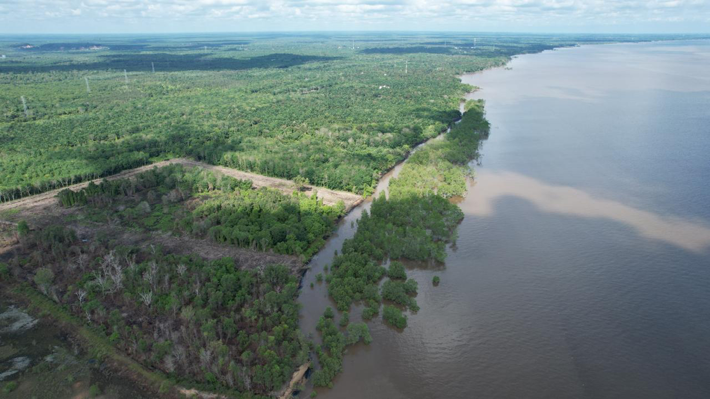
Aerial view of a tropical coastal landscape in Sumatra, Indonesia, where vegetation edge validation was conducted to assess coastal change using satellite imagery. Credit: Idham Nugraha / University of Glasgow.
VedgeSat uses a pre-trained machine learning algorithm to classify every pixel of the satellite imagery as either ‘vegetation’ or ‘non-vegetation’, which enables it to establish the vegetation line in each site.
The tool’s results, which were validated against GPS surveys of Padang and high-res Planetscope images of Dumai showed that it performed very well in areas with dense vegetation.
It was capable of determining the vegetation line with errors of seven metres or less in sites which were thickly covered in mangrove trees, dense vegetation, or oil-palms in plantations.
It was less accurate in patchier areas like grassy or sparsely-forested sections of beaches, where the tool was less able to clearly identify the edge, and the error expanded to 50 metres or more.
In those cases, however, the team found that manually tuning the tool to account for the differences in terrain and the colour of seawater helped reduce the error rate.
Idham Nugraha, of the University of Glasgow’s School of Geographical & Earth Sciences and the Universitas Islam Riau in Indonesia, is the paper’s corresponding author.
He said: “This study provides the first benchmark for automated vegetation edge detection in tropical systems and demonstrates the scalability of satellite-based coastal monitoring.
“By enabling large-scale, repeatable, and cost-effective analysis, VedgeSat has the potential to support coastal management in data-scarce regions worldwide.”
Professor Larissa Naylor, a co-author of the paper, said: “As climate change intensifies and destructive storms become more common, our coasts will be affected in ways that can be difficult to predict in advance.”
“More than a tenth of the world’s population live in coastal areas, putting homes, businesses, infrastructure and wildlife all under threat from the effects of climate change. Our aim in building VedgeSat was to make it easier and cheaper for decisionmakers to map their changing coastlines, and make more informed and impactful choices as a result”, said paper co-author Dr Martin Hurst.
Dr Freya Muir, who developed VedgeSat and co-authored the paper, said: “It’s very encouraging to see that VedgeSat is just as capable of analysing tropical coasts as it was for the coasts of the country where it was developed. We hope that these results will encourage uptake of the tool around the world to help deal with the challenges of our changing planet.”
The team’s paper, titled ‘Extending a Scalable Satellite-Based Vegetation Edge Detection Framework to Diverse Tropical Coasts’, is published in Frontiers in Marine Science.
The research was supported by funding from the Indonesia Endowment Fund for Education, and the Natural Environment Research Council (NERC), part of UKRI.
First published: 4 March 2026