

Glasgow Archaeology student wins this years Association for Environmental Archaeology Undergraduate Dissertation Prize!
Published: 27 July 2026
We celebrate the achievement of our recent graduate, Lori Smith, who has been awarded a prestigious international prize for the quality of her undergraduate dissertation.
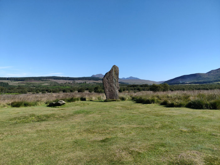
Machrie Moor Stone Circle, Arran. Photo: Nicki Whitehouse
Lori’s dissertation focused on the geoarchaeological investigation of the Blackwaterfoot floodplain, Arran, Scotland, to understand how sea level and other hydrological changes drove landscape changes in this important archaeological landscape. The research represents an important contribution towards ongoing investigations of the prehistoric landscapes at Drumadoon and Machrie Moors led by the University of Glasgow. Lori’s research was supervised by Prof Nicki Whitehouse and Dr James O’Driscoll and will continue over the coming year as part of her postgraduate research.
Other University of Glasgow colleagues involved in this project include Prof Kenny Brophy, alongside colleagues from Archaeology Scotland; University of Bournemouth; Birkbeck College, London; University of Southampton; University of Birmingham; University of Coventry; the Artic University of Norway; landowner of the Drumadoon Estate.
More information on the Drumadoon project can be found here: https://drumadoonpasts.gla.ac.uk
The new research is summarized by Lori:
“My dissertation aimed to investigate how sea level change on the Isle of Arran may have impacted the land use and settlement of Neolithic communities, specifically focusing on the Blackwaterfoot floodplain on the South-west of the island. As Arran does not currently have its own sea level index point, which provides a date, elevation and coordinate of past sea levels, I had to collect my own data to reconstruct sea levels during the Neolithic period.
To do this, I conducted geoarchaeological coring surveys at four sites on the Blackwater floodplain, selected using LiDAR data. Coring transects were used to create a stratigraphic profile which gives information on how the environment changed through time. Samples from one core underwent grain size and organic content analyses giving a more in-depth look at the potential depositional environment of sediments, telling us whether estuarine or sea water conditions may have ever reached the elevation of the coring sites. I then created a digital elevation model of the Blackwaterfoot floodplain using GIS software to manually ‘flood’ the landscape, seeing how it interacted with data from key archaeological sites and the coring locations. I used this alongside my own data from fieldwork and known Scottish Quaternary data to interpret past sea level activity on Arran.
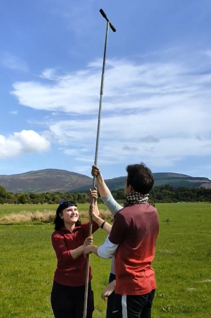
Coring floodplain of the Blackwater River, Arran. Photo: Lori Smith
Through this, a high-stand period between 15-20m OD was suggested, followed by significant isostatic fall to 10-15m OD during the Neolithic period. Peat-clay sequencing found at ~20m OD supported the high-stand theory, while recessional sand bars found between 10 and 15m OD evidenced the isostatic fall in sea level. Through correlating these results with radiocarbon-dated peat depths from the Machrie Moor pollen record, I aligned the sequencing with the Mesolithic period, placing the high-stand slightly later than Britain’s eustatic high-stand. This was further supported by the presence of an ice dome on Arran during glaciation, which likely slowed local isostatic rebound.
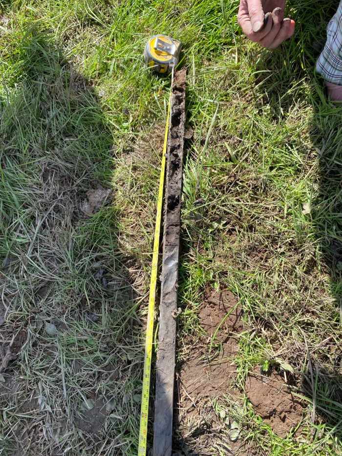
Sediment record obtained from coring floodplain. Photo: Lori Smith
These interpretations provided a framework for understanding the environmental context of Arran’s early settlement and land use, facilitating the correlation of Neolithic land use shifts with sea level changes. For example, a shift from arable to pastoral farming was found to align with sedimentary changes indicative of sea level rise, suggesting a forced shift due to declining fertile land.
Alongside practical impacts, sea level change was likely a significant agent in the monumental use of the landscape. The evolving coastline would have reshaped the perceived significance attached to monumental settings, developing shared cultural memory. This was demonstrated through the positioning of Arran’s chambered cairns, which have long been associated with the sea, changing in relation to the sea through time.
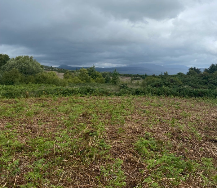
Drumadoon landscape cursus monument. Photo: Lori Smith
The positioning of key archaeological sites, Drumadoon and Machrie Moors also evidence this. During marine inundation between 20-25m OD, Drumadoon becomes a peninsula connected only in direct alignment with Machrie Moor. I theorized that this placement was deliberate, creating a spectacle during once in a lifetime flooding events, potentially sparking ceremonial activity.
As well as impacting insular settler activity on Arran, I also suggested that the changing seascape would have affected the facilitation of cultural exchange across the Western Seaways as a whole. Sea level change would have impacted accessibility between islands and coastal locations, resulting in the variation in connectivity and shared culture across Scotland’s Neolithic. This highlighted our need to acknowledge the sea as an active agent in the development of Neolithic cultural systems across the Western Seaways.
This research will continue over the coming year, aiming to identify definitive SLIPs for Arran while broadening the practical research scope across coastal and island sites of the Western Seaways”
Congratulations to Lori! We look forward to working with you as this research develops.
First published: 27 July 2026
<< Latest news