

Peatlands through time and space
WP1 aims to establish the current and future physical capacity of land in the case study regions to contribute to net zero and prioritise areas for peatland restoration.
Co-leads
Adrian Bass and Nicki Whitehouse
Contributors
Jane Bunting, Graham Ferrier, Jens-Arne Subke, Jiren Xu, Philip Barratt, Muhammad Jehanzaib, Stuart Munro, Wenguang Tang, Thomas Prentice and Kenny Roberts
Approach
Work package 1 examines where peatland restoration should take place in the Humber and Forth catchment case study areas by collating historic and new data to elucidate patterns of peatland through space and time.
The team usespublicly available LiDAR data, combined with drone-deployed LiDAR surveys and borehole data, to map modern and historic peat boundaries and depths. Targeted fieldwork and new data collection ground-truths and supplements existing data.
The team also uses a temporal Multiple Scenario Approach, combined with reconstructed palaeogeography, existing pollen records and archaeological data, to quantify land use change through time. These methods allow for the mapping and characterising of both existing peatland cover and ‘hidden’ peatlands now used for other purposes, including agriculture. These data will be used to prioritise areas for restoration for the case study regions, under different climate scenarios, that will improve per hectare carbon sequestration land use while recognising the historic environment.
The work package will ensure methods are replicable to other regions. The capacities of the land established in this work package will provide the foundation for discussions in the second work package and the baseline data for the Peatland Triage Tool.
Key outputs
- Maps and datasets of the case study regions representing depth, type, age and condition of peatland.
- Prioritisation of areas for restoration based on past land use, present land condition, historic environment sensitivity mapping and future climate change.
- A methods template for replicating these peatland maps in other regions.
Photo in banner: Hatfield Moors cart warping with (from left to right) Rachel McDonald, Ciara Sutherland, Alexandra Vasileva and Stuart Munro (Photo credit: Wenguang Tang)
- WP2: Social capacities for peatland transformations
- WP3: Peatland Triage Tool
- WP4: Policy and practice for peatland transformations
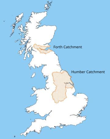
Catchment outlines sourced from the Scottish Environment Protection Agency and the Environment Agency through the Open Government License v3.0.
Map created by Phil Barratt.