

Reconstructing past land use in southern Africa’s dry lands: Insights from Botswana
Published: 29 May 2026
Paidamoyo Chingono shares details of her secondment at the University of Botswana
In February 2026, Paidamoyo Chingono, one of the Agri-Dry Doctoral Candidates (DC), undertook a secondment at the University of Botswana. The primary objectives of the secondment were to examine curated archaeobotanical material (seeds and charcoal) at the National Museum and Art Gallery of Botswana for radiocarbon dating, conduct archival research, engage with regional archaeologists, and receive training in remote-sensing techniques relevant to reconstructing past land-use practices in southern Africa.
Paidamoyo’s visit to the National Museum and Art Gallery of Botswana is relevant to the development of a geospatial database for past land-use systems in southern Africa, which she is currently working on. Radiocarbon dates are essential for establishing time windows that help researchers quantify changes in historical land-use strategies that affect food production, societal structures, and Earth systems.
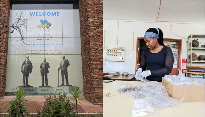
Visit to the Botswana National Museum to examine archaeobotanical samples. (Image credits: Thamary Mukuya. Copyright ©2026).
After days immersed in archival research on past land-use practices at the museum library and the Botswana National Archives and Records Services, the shift to remote-sensing training for land-use purposes with Dr Olaotse Lokwalo Lekone was a refreshing change. Through these sessions, Paidamoyo engaged in discussions on integrating archaeological evidence with geospatial indicators to reveal possible patterns of hunting, gathering, foraging, and pastoral activity in southern Africa’s drylands, including identifying historic water sources such as pans, in remotely sensed imagery.
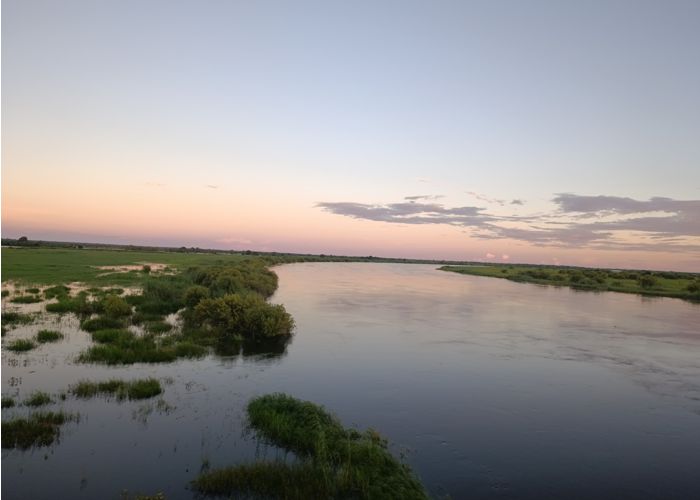
Okavango Delta Landscape in the Northwest District of Botswana (Image credits: Thamary Mukuya. Copyright ©2026)
Paidamoyo also held informative consultations with Dr Phenyo Thebe and Dr Sara Mothulatshipi, focusing on archaeological signatures in the Kalahari Desert, where the shifting Kalahari sands often bury archaeological evidence. They described the physical environment, for example, the Okwa Valley, the salt pans, and fluctuations in the Kalahari Desert’s water table, and explained how these features influenced historic land-use strategies in arid regions. They also highlighted the important role of Indigenous Knowledge Systems in identifying and understanding these important locations.
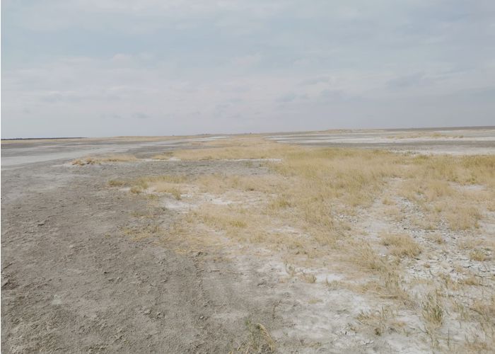
Salt pans in Botswana's Central District. Pans appear on Google Earth as white/grey patches dotted across the desert (Image credits: Thamary Mukuya. Copyright ©2026).
The trip concluded with a visit to the National Museum of Human Sciences in Harare and the National Archives of Zimbabwe for archival research. Paidamoyo is grateful to the University of Botswana History Department, the National Museum and Art Gallery of Botswana, as well as Dr Olaotse Lokwalo Lekone and Agri-Dry DCs Thamary Mukuya and Mncedisi Taala. Paidamoyo’s research on Changes in land use over the Holocene: Southern Africa is internally supervised by Prof Nicki Whitehouse and Dr James O'Driscoll.
First published: 29 May 2026
<< Latest news