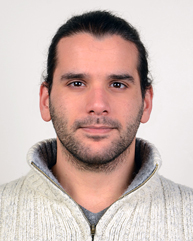
Mr Georgios Maniatis
- Honorary Research Associate, Honorary Research Associate (School of Geographical & Earth Sciences)
Research interests
Biography:
Georgios Maniatis completed his PhD in the School of Geographical and Earth Sciences and the School of Computing Sciences at the University of Glasgow. He has completed a 5-year diploma in Environmental Engineering and an MSc degree in Freshwater System Sciences. During his PhD he focused on the Environmental Sensor Networks and the construction of a sensing system optimized to monitor the dynamics of sediment transport processes in fluvial systems. This project included the evaluation, extension and redefinition of the criteria that are relevant to the incipient motion of coarse sediments so they are compatible with the sensing equipment available today. In this context, he works on improving the prediction power of sediment transport models with the analysis of inertial data derived by cheap MEMS sensors (commercially available and customized).
Research Interests:
- Incipient motion of coarse sediments
- Sediment transport
- Fluvial geomorphology
- Environmental transport processes
- Environmental sensors
- Applied mathematics
Grants
- Early Career Scientist Award, British Society of Geomorphology, £4132 (December 2017)
- SAGES, PEER Grant, £1500 (January 2017)
- University of Glasgow funding for the development of sensing equipment, £10000 (Summer 2014, Co-I; project led by Prof. Trevor Hoey)
- MASTS Technology, Platforms and Sensors Forum, £1000 (Summer 2015; Co-I; project led by Dr Larissa Naylor)
- Kelvin Smith Scholarship provided by the University of Glasgow (2012-2016) [First supervisor: Trevor Hoey; effective value c.£60k ]
Teaching
- Techniques Course - Level 3 (2011-2017) School of Geographical and Earth Sciences
- Introduction to Statistics - Level 2 (2015-2017) School of Geographical and Earth Sciences
- Demonstrator: York Field Trip (Level 2), Hydrology (Level 4,M), Catchment Management (Level 4,M)
Research datasets
Additional information
https://www.researchgate.net/profile/Georgios_Maniatis


